

Mapping History.
Managing Places.
Connecting Communities
Spatial Agency creates Esri-based cemetery and cultural heritage systems that help communities preserve records, improve operations, and connect people with the places and stories that shaped them.

Transform burial records, cemetery maps, field surveys, and local knowledge into an accurate system for managing gravesites, planning for the future, and helping families locate loved ones.
Cemetery Mapping & Management

Connect cemeteries, people, census records, historic places, photographs, maps, and life events to create an evolving geographic portrait of your community.
Cultural Fabric

Esri Partner
Woman-Owned
Small Business

Field Survey &
GIS Expertise
Built for Local Government & Community Organizations

Manage
Accurate records, cemetery layouts, inspections, work orders, ownership, transactions, and long-term planning.
Serve
Public searches, mobiles maps, memorial information, historical exploration, and better access for families and researchers.
Preserve
Historic maps, cemetery records, census connections, photographs, biographies, and community stories preserved for future generations.
Our platform helps communities manage with confidence today, serve people more effectively and preserve history for generations to come.
POWERFUL. INTUITIVE. CONNECTED

Conceptual interface illustrating the Cultural Fabric vision for Black Hawk County
Cultural Fabric in Black Hawk County
Spatial Agency is building the geographic foundation for a connected local-history mapping system in Black Hawk County by bringing census records, historic enumeration districts, cemetery data, and community research together in one spatial framework.

300,000+ census records organized and connected to their historic enumeration districts.
Enumeration district maps georeferenced and aligned with modern geography.
Spring Creek Chapel Cemetery mapped as an initial cemetery gateway.
Next phase: connect headstones and people to mapped residences, life events, and historical records.
Partnership opportunities: invite libraries, universities, archives, and local-history organizations to help research, interpret, and connect Black Hawk County’s people and places
Featured Projects

Mt. Zion- Female Union Band Society Cemeteries
A comprehensive system preserving burial records and supporting public access at one of Washington DC's most significant African American cemetery sites.

Scott County Cemetery Mapping Initiative
A pilot project demonstrating our Esri-based partnership model for preserving cemetery records and building toward connected countywide systems

Iowa Veterans Heritage Trail
Connecting veterans, military service, burial places, and life events across Iowa through an interactive public history map.
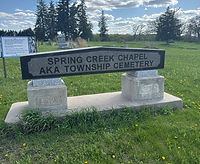
Spring Creek Chapel Cemetery
A mapped cemetery serving as the first cemetery gateway into the Black Hawk County Cultural Fabric framework
Built Through Local Partnerships
We provide the Esri-based geographic framework, applications, field methods, data model, training, and technical support. You bring local knowledge, records, research, and stewardship

Local Governments

Cemetery Managers

Township Trustees

Libraries & Historical Societies

Genealogists & Family Historians
" Allison truly captured the essence of our cemetery project with a modern, visually appealing website that is both user friendly and highly functional.
Good Shepherd Catholic Cluster - New Hampton, Iowa

Additional GIS Capabilities
Custom cartogarphy, Esri solution implementation, historic-map georeferencing, data migration, and specialized geographic application development.
